File:Panorama vom Aussichtsturm Sandberg, Platt (Gemeinde Zellerndorf), Weinviertel 6186.jpg

Original file (21,802 × 4,819 pixels, file size: 46.22 MB, MIME type: image/jpeg)
This is a file from the Wikimedia Commons. The description on its description page there is copied below.
Summary
| Warning | The original file is very high-resolution. It might not load properly or could cause your browser to freeze when opened at full size. | Open in ZoomViewer |
|---|
| DescriptionPanorama vom Aussichtsturm Sandberg, Platt (Gemeinde Zellerndorf), Weinviertel 6186.jpg |
Deutsch: Panorama vom Aussichtsturm Sandberg, Platt (Gemeinde Zellerndorf), Weinviertel
English: Observation tower, Platt, municipality Zellerndorf, Lower Austria (Weinviertel)
|
|||
| Date | ||||
| Source | Own work | |||
| Author | ||||
| Attribution (required by the license) InfoField | © Kellergassen Niederösterreich 2016 / Wikimedia Commons / | |||
InfoField | © Kellergassen Niederösterreich 2016 / Wikimedia Commons | |||
| Permission (Reusing this file) |
|
| Camera location | 48° 39′ 31″ N, 15° 57′ 59″ E | View this and other nearby images on: OpenStreetMap |
|---|
Licensing
- You are free:
- to share – to copy, distribute and transmit the work
- to remix – to adapt the work
- Under the following conditions:
- attribution – You must give appropriate credit, provide a link to the license, and indicate if changes were made. You may do so in any reasonable manner, but not in any way that suggests the licensor endorses you or your use.
- share alike – If you remix, transform, or build upon the material, you must distribute your contributions under the same or compatible license as the original.
|
Please do not upload an updated image here without consultation with the Author. The author would like to make corrections only at his own source. This ensures that the changes are preserved. |
| Annotations InfoField | This image is annotated: View the annotations at Commons |
Raiffeisen Lagerhaus, die störenden Schandflecken, aber auch Denkmäler von Niederösterreich.
Znaim, gotischer Rathausturm in Znaim, erbaut in den Jahren 1445 - 1448 von Mikuláš von Sedlešovice. Er ist das Wahrzeichen der Stadt und eines der bedeutendsten gotischen Bauwerke in der Tschechischen Republik. Der Turm mit einer Aussichtsgalerie ist ganzjährig geöffnet.
Znojmo, Gotická radniční věž ve Znojmě postavená v letech 1445 - 1448 Mikulášem ze Sedlešovic. Je symbolem města a patří k nejvýznamnějším gotickým stavbám v ČR. Věž s vyhlídkovým ochozem je přístupná celoročně.

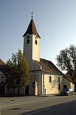
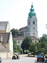
Watzelsdorf, Gemeinde (Zellerndorf)
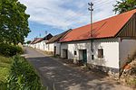
Kellergasse Point
Kellergasse Philipp und Jakob, Zellerndorf
Kellergasse Pillersdorfer Straße, Zellerndorf
Veitelbergkellergasse, Watzelsdorf
Veitelbergkellergasse, Zellerndorf

|
This image has been assessed using the Quality image guidelines and is considered a Quality image.
العربية ∙ جازايرية ∙ беларуская ∙ беларуская (тарашкевіца) ∙ български ∙ বাংলা ∙ català ∙ čeština ∙ Cymraeg ∙ Deutsch ∙ Schweizer Hochdeutsch ∙ Zazaki ∙ Ελληνικά ∙ English ∙ Esperanto ∙ español ∙ eesti ∙ euskara ∙ فارسی ∙ suomi ∙ français ∙ galego ∙ עברית ∙ हिन्दी ∙ hrvatski ∙ magyar ∙ հայերեն ∙ Bahasa Indonesia ∙ italiano ∙ 日本語 ∙ Jawa ∙ ქართული ∙ кыргызча ∙ 한국어 ∙ kurdî ∙ Lëtzebuergesch ∙ lietuvių ∙ македонски ∙ മലയാളം ∙ मराठी ∙ Bahasa Melayu ∙ Nederlands ∙ Norfuk / Pitkern ∙ polski ∙ português ∙ português do Brasil ∙ qaraqalpaqsha ∙ rumantsch ∙ română ∙ русский ∙ sicilianu ∙ slovenčina ∙ slovenščina ∙ shqip ∙ српски / srpski ∙ svenska ∙ தமிழ் ∙ తెలుగు ∙ ไทย ∙ Tagalog ∙ toki pona ∙ Türkçe ∙ українська ∙ Oʻzbekcha ∙ vèneto ∙ Tiếng Việt ∙ 中文 ∙ 中文(简体) ∙ 中文(繁體) ∙ +/− |
Captions
Items portrayed in this file
depicts
48°39'31.00201"N, 15°57'58.99799"E
7 June 2016
image/jpeg
File history
Click on a date/time to view the file as it appeared at that time.
| Date/Time | Thumbnail | Dimensions | User | Comment | |
|---|---|---|---|---|---|
| current | 19:00, 13 June 2016 | 21,802 × 4,819 (46.22 MB) | Hubertl | Brightness | |
| 17:48, 13 June 2016 | 21,802 × 4,819 (69.87 MB) | Kellergassen |
File usage
The following page uses this file:
Metadata
This file contains additional information, probably added from the digital camera or scanner used to create or digitize it.
If the file has been modified from its original state, some details may not fully reflect the modified file.
| Camera manufacturer | Canon |
|---|---|
| Camera model | Canon EOS 6D |
| Author | Hubertl |
| Copyright holder |
|
| Exposure time | 1/640 sec (0.0015625) |
| F Number | f/8 |
| ISO speed rating | 100 |
| Date and time of data generation | 18:41, 7 June 2016 |
| Lens focal length | 170 mm |
| Latitude | 48° 39′ 31″ N |
| Longitude | 15° 57′ 59″ E |
| Altitude | 357.3 meters above sea level |
| Label | Rot |
| City shown | Gemeinde Zellerndorf |
| Horizontal resolution | 240 dpi |
| Vertical resolution | 240 dpi |
| Software used | Adobe Photoshop Lightroom 6.6 (Windows) |
| File change date and time | 20:57, 13 June 2016 |
| Exposure Program | Manual |
| Exif version | 2.3 |
| Date and time of digitizing | 18:41, 7 June 2016 |
| APEX shutter speed | 9.321928 |
| APEX aperture | 6 |
| APEX exposure bias | 0 |
| Maximum land aperture | 3 APEX (f/2.83) |
| Metering mode | Partial |
| Flash | Flash did not fire, compulsory flash suppression |
| Color space | sRGB |
| Focal plane X resolution | 1,520 |
| Focal plane Y resolution | 1,520 |
| Focal plane resolution unit | 3 |
| Custom image processing | Normal process |
| Exposure mode | Manual exposure |
| White balance | Auto white balance |
| Scene capture type | Standard |
| GPS time (atomic clock) | 16:39 |
| Satellites used for measurement | 12 |
| Receiver status | Measurement in progress |
| Measurement mode | 3-dimensional measurement |
| Measurement precision | Poor (31.5) |
| Geodetic survey data used | WGS-84 |
| GPS date | 7 June 2016 |
| GPS tag version | 0.0.3.2 |
| Serial number of camera | 053024001946 |
| Lens used | EF70-200mm f/2.8L IS II USM |
| Date metadata was last modified | 22:57, 13 June 2016 |
| Unique ID of original document | 63E3618695684758FE0E3EB14219AF0F |
| Province or state shown | Niederösterreich |
| Country shown | Österreich |
| Code for country shown | AT |
| IIM version | 4 |


